Student Spotlight: Zainab Akhtar
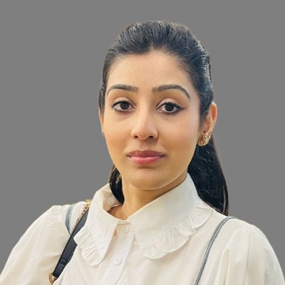
This week, we shine a spotlight on OMSCS student Zainab Akhtar. Keep reading to learn more about Zainab's background, work with ACLED, favorite courses, and more!
What is your academic and/or professional background? If you're currently working, what do you do?
As a geospatial expert in the humanitarian domain, I’ve leveraged my academic and professional experiences to contribute meaningfully to the United Nations Sustainable Development Goals (UN SDGs), particularly focusing on climate action and building sustainable cities and communities. My work revolves around integrating geospatial technologies such as GIS, remote sensing, and machine learning to enhance disaster preparedness, response, and resilience.
Before joining the OMSCS program, I was a researcher at the Qatar Computing Research Institute within the Crisis Computing Team where I led the development of the Flood Insights System, an innovative and patented platform that integrates AI, geospatial data, and social sensing to monitor and predict flood events. This tool was instrumental during the 2022 Pakistan floods, enabling the United Nations Development Programme (UNDP) and local authorities to assess impacts and prioritize resources efficiently. As a result, our system was shortlisted for the World Summit Awards 2023 for its real-world impact. Witnessing the transformative potential of AI for social good fueled my aspiration to specialize in GeoAI, which led me to OMSCS.
During my time in OMSCS, I’ve worked on projects with significant global impact. Collaborating with UNDP’s Crisis Bureau through CS 6150: Computing for Good, I enhanced political violence forecasting models. Similarly, my work with Vision-Aid involved improving their healthcare systems' sustainability and efficiency, empowering staff with advanced data tools for informed decision-making. Additionally, as part of a Vertically Integrated Project (VIP), I explored the complex interactions between climate change, conflict, and migration by taking a systems design approach.
Building on these experiences, I currently work as a GIS Analyst at Armed Conflict Location and Event Data (ACLED), supporting data science and analytical teams by managing spatial databases, conducting spatial analyses, and mapping conflict complexities.
At every step of my journey, my goal has been to blend technology, innovation, and collaboration to foster real-world change, ensuring the next generation is better equipped to face and transform the challenges of disasters. Notable accolades include being named one of the Geospatial World 50 Rising Stars for 2024, being featured in the International Society for Photogrammetry and Remote Sensing Student Consortium Newsletter Spotlight (August 2023), and being invited as an Associate for Réseau Consulting, recognizing my contributions as one of 30+ women in GIS. As a lead author, I have contributed to top-tier scientific publications at venues including WWW’23 and AAAI’24 (with Deployed Application Award). I have showcased my work at several prestigious platforms such as the Al Jazeera Conference: Artificial Intelligence In The Media, Artificial Intelligence for Collective Intelligence (AI4CI) organized by the United Nations Development Programme Accelerator Labs and QCRI, as well as United Nations Department of Political and Peacebuilding Affairs (UN DPPA) Innovation Cell's e-Analytics course hosted at QCRI.
What was your favorite course or professor in OMSCS, and why?
In Spring 2024, I enrolled in CS 6150: Computing for Good, taught by Dr. Santosh Vempala, a course that perfectly combines technology and social impact. The course allowed students to either work on pre-approved projects or propose their own. I chose the latter, leveraging my network to collaborate with the UNDP Crisis Bureau on forecasting political violence. My team developed a unified forecasting tool that integrated models like ACLED CAST, ViEWS, and Conflict Forecast into an ensemble framework visualized through an interactive, web-based dashboard. This tool explores advanced data visualizations using Plotly Dash, with the potential to become a global testbed for evaluating conflict forecast performance. The experience directly influenced my current role at ACLED, a nonprofit providing disaggregated conflict data.
Following CS 6150, I pursued CS 8903: Special Problems with Dr. Vempala in Fall 2024, focusing on challenges faced by visually impaired communities. Partnering with Vision-Aid, a nonprofit specializing in assistive technologies, I enhanced their application’s usability, scalability, and performance. By automating previously manual data analysis and incorporating real-time user feedback, I empowered Vision-Aid staff to make informed decisions, optimizing their impact. Positive feedback from the partners during weekly meetings was immensely rewarding, as it demonstrated the real-world value of my contributions.
Across both courses, a shared principle was sustainable software development—using well-documented, cost-effective libraries and adhering to Agile methodologies for flexibility and responsiveness. These experiences not only showcased the power of technology to drive meaningful change but also strengthened my dedication to creating sustainable, impactful solutions.
I highly recommend CS 6150 and CS 8903 to students interested in using technology for social good and creating real-world impact. These courses provide a unique opportunity to collaborate with global organizations, work on meaningful projects, and gain insights into how computing can address critical societal challenges.
Why did you choose to pursue computer science?
With a Bachelor’s in Information Systems from Carnegie Mellon University, I developed a strong foundation in Python programming, databases, web development, GIS, business intelligence, and statistics—all areas I thoroughly enjoyed exploring. After graduation, I joined Qatar Computing Research Institute, where I collaborated with leading scientists and researchers from around the world. This experience introduced me to the transformative power of Applied AI through the lens of social computing, igniting my passion for fields such as machine learning, deep learning, natural language processing (NLP), and computer vision.
At QCRI, I worked on projects involving satellite imagery processed through deep learning models, social media images analyzed using object detection (computer vision), and text processing with NLP models. While I wasn’t directly involved in building the AI components of the Flood Insights System, I played a critical role by leading essential sub-tasks such as taxonomy creation, data collection, cleansing, and labeling. These contributions were pivotal in ensuring the effectiveness of the AI models. This experience fueled my interest in GeoAI and inspired me to pursue Georgia Tech’s OMSCS program to deepen my AI expertise and integrate it with my geospatial skills.
Through OMSCS, I’ve completed key courses like CS 7641: Machine Learning, where I explored theoretical foundations while applying concepts to real-world datasets through research-driven assignments. These assignments emphasized not just accuracy but understanding the "why" behind outcomes, through in-depth analysis and interpretation of results.
In CS 7643: Deep Learning, I had the opportunity to lead a final project connected to my volunteer work with Omdena in collaboration with the nonprofit Open Development & Education (OpenDevEd). The project focused on predicting indoor temperatures in rural Tanzanian schools, a critical factor in improving educational infrastructure. Data limitations in Tanzania posed significant challenges, prompting me to expand testing to South Africa for my Deep Learning coursework. Here, LSTMs consistently outperformed models like CNNs, RNNs, and GRUs. The research’s next steps include leveraging building-to-building transfer learning to enhance model generalizability—a promising direction inspired by related studies. I look forward to continuing this collaboration with OpenDevEd in the future.
Looking ahead, I am eager to enroll in Natural Language Processing and Computer Vision to further integrate my learning and contribute impactful research.
If you could collaborate with any person, past or present, who would it be, and why?
If I could collaborate with anyone, it would be Dr. Qiusheng Wu, Dr. Liping Yang, and Dr. Siqin (Sisi) Wang, whose groundbreaking work lies at the intersection of geospatial science, computer science, and GIS. Dr. Wu’s innovative contributions, such as GEEMap and tools integrating Google Earth Engine, exemplify his commitment to advancing geospatial research. Similarly, Dr. Yang and Dr. Wang are at the forefront of applying geospatial analytics to solve complex environmental and societal challenges. Their work not only inspires me but also provides a roadmap for how geospatial technologies can drive meaningful impact. Collaborating with these experts would be an incredible opportunity to contribute to transformative projects and deepen my expertise in this dynamic field.
Find Zainab on...
ACLED Website: https://acleddata.com/about-acled/our-team/
Réseau Websitehttps://www.reseauconsulting.com/associates
